
Download area 1.0
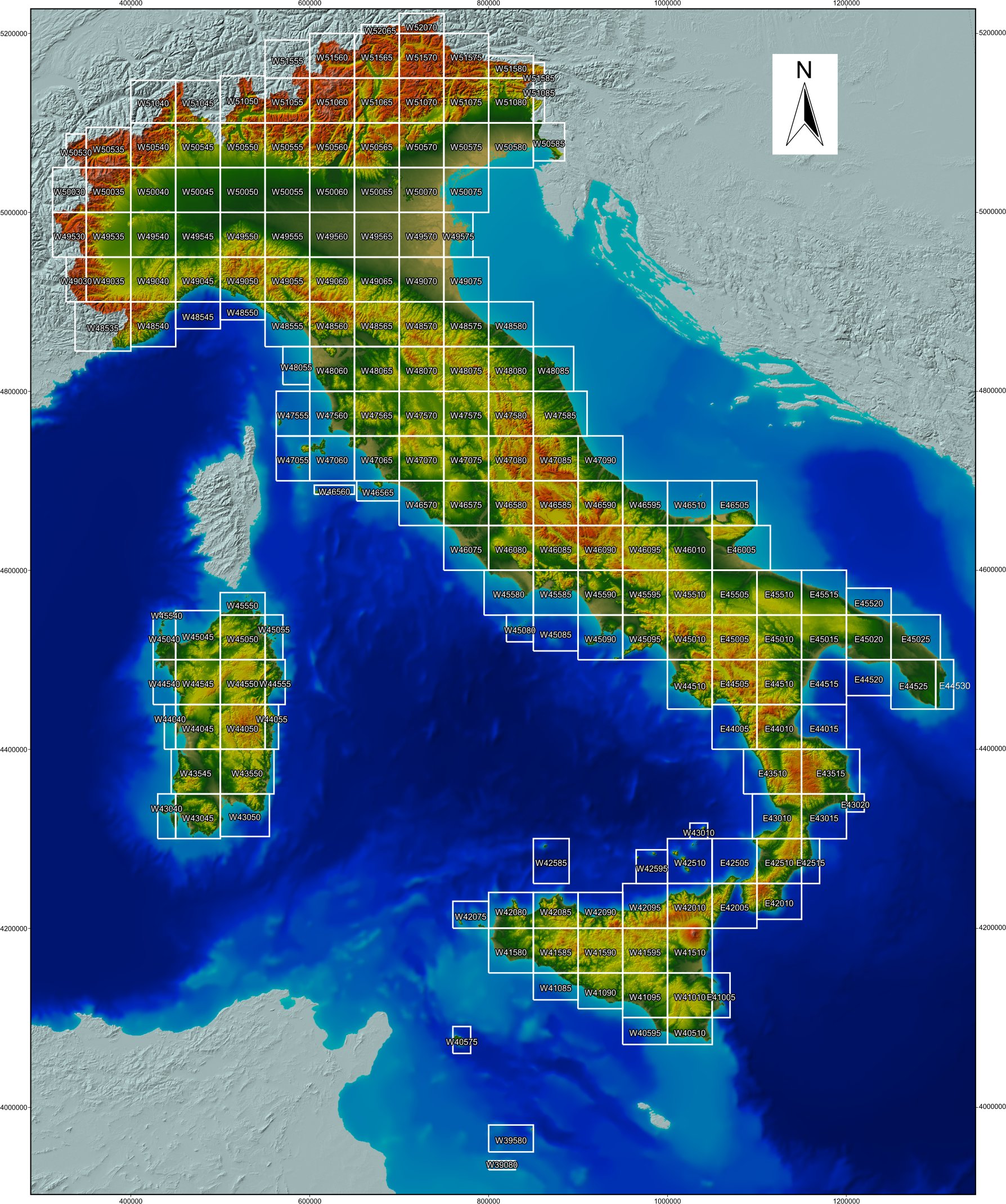
Click on the tiles below to download the DEM. To get a color-shaded image of the whole Italy derived from a version of the DEM at 100 m resolution click here.
TINITALY is published with a CC BY 4.0 license and can be used freely, even partly, but it must be cited as follows.
Tarquini S., Isola I., Favalli M., Battistini A. (2007) TINITALY, a digital elevation model of Italy with a 10 m-cell size (Version 1.0) [Data set]. Istituto Nazionale di Geofisica e Vulcanologia (INGV). https://doi.org/10.13127/TINITALY/1.0.”
Details about the TINITALY DEM can be found in the following references.
*Tarquini S., I. Isola , M. Favalli , F. Mazzarini, M. Bisson, M.T. Pareschi, E. Boschi (2007). TINITALY/01: a new Triangular Irregular Network of Italy, Annals of Geophysics, 50, 407-425. https://doi.org/10.4401/ag-4424
§Tarquini S., Vinci S., Favalli M., Doumaz F., Fornaciai A., Nannipieri L., (2012). Release of a 10-m-resolution DEM for the Italian territory: Comparison with global-coverage DEMs and anaglyph-mode exploration via the web, Computers & Geosciences , 38, 168-170. https://doi.org/10.1016/j.cageo.2011.04.018
Tarquini S., Nannipieri L., (2017) The 10 m-resolution TINITALY DEM as a trans-disciplinary basis for the analysis of the Italian territory: Current trends and new perspectives. Geomorphology, 281, 108-115. https://doi.org/10.1016/j.geomorph.2016.12.022