

WMS service
A WMS (Web Map Service) allows visualization, navigation, change the display scale (zooming in and out), change in the framed area portion (pan), overlay spatial data sets and to display pages information and relevant content of metadata (in agreement with Directive 2007/2 / EC).
IIn agreement with INSPIRE guidelines for the implementation of consultation services, this service is implemented using the OGC™ (Open Geospatial Consortium Catalogue Services Specification 2.0.2) and using standard ISO 19128 – Web Map Service (WMS) 1.3.0.
The generated map is the representation of spatial information in the form of a digital image file, and it cannot be edited or spatially analyzed by end users.
The OGC links supply, beside the DEM itself (TINItaly_DEM), the navigation of the following DEM-derived layers:
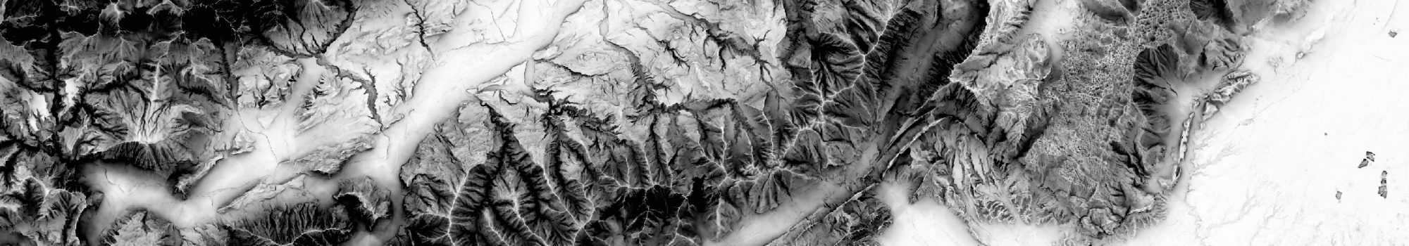
- (i) shaded relief map (TINItaly_Hillshade);
- (ii) slope map (TINItaly_Slope);
- (iii) Sky view Factor (SVF) map using 2.5σ clipping as technique for image enhancement (TINItaly_SVF_2d5);
- (iv) SVF map using equal area equalization as technique for image enhancement (TINItaly_SVF_EA);
- (v) openness down map using equal area equalization as technique for image enhancement (TINItaly_OD);
- (vi) Hue-Saturation-Value (HSV) composition image with slope (2.5σ clipping) as saturation and SVF (2.5σ clipping) as value, according to RRIM (Red Relief Image Maps) style maps (TINItaly_HSV);
- (vii) slope map using 2.5σ clipping as technique for image enhancement (TINItaly_Slope_2d5).
For more information about the generation of the DEM-derived products refer to Favalli and Fornaciai (2017).
| Name | GetCapabilities | TINITALY DEM-derived images obtained as illustrated in Favalli and Fornaciai (2017, https://doi.org/10.1016/j.geomorph.2017.02.029). |
|---|---|---|
| Tinitaly browsing DEM & other layers |  |