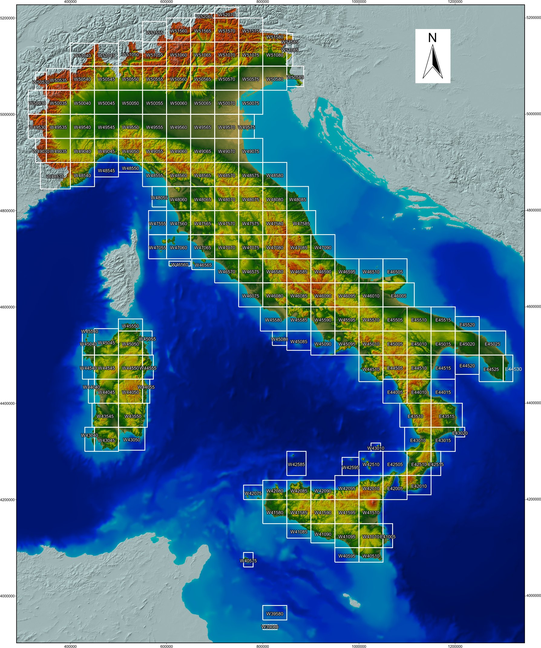
Click on the tiles below to download the DEM. To get a color-shaded image of the whole Italy derived from a version of the DEM at 100 m resolution click here.
Within the zip folder, the user will find the accompanying notes explaining the main novelties of TINITALY 1.1.
TINITALY 1.1 is published with a CC BY 4.0 license and can be used freely, even partly, but it must be cited as follows..
Tarquini S., I. Isola, M. Favalli, A. Battistini, G. Dotta, (2023).
Details about the TINITALY DEM can be found in the following references.
*Tarquini S., I. Isola , M. Favalli , F. Mazzarini, M. Bisson, M.T. Pareschi, E. Boschi (2007). TINITALY/01: a new Triangular Irregular Network of Italy, Annals of Geophysics, 50, 407-425. https://doi.org/10.4401/ag-4424
§Tarquini S., Vinci S., Favalli M., Doumaz F., Fornaciai A., Nannipieri L., (2012). Release of a 10-m-resolution DEM for the Italian territory: Comparison with global-coverage DEMs and anaglyph-mode exploration via the web, Computers & Geosciences , 38, 168-170. https://doi.org/10.1016/j.cageo.2011.04.018
Tarquini S., Nannipieri L., (2017) The 10 m-resolution TINITALY DEM as a trans-disciplinary basis for the analysis of the Italian territory: Current trends and new perspectives. Geomorphology, 281, 108-115. https://doi.org/10.1016/j.geomorph.2016.12.022