

WMTS service
A WMTS (Web Map Tile Service) provides a standard based solution as a complementary approach to the WMS for tiling maps. It serves digital maps of spatially referenced data using tile images with predefined content, extent, and resolution. To speed up the performance of the service, for some zoom levels the tiles have been generated in advance while for others they are generated on the fly employing a caching mechanism.
This service is implemented using the OGC™ OpenGIS Web Map Tile Service Implementation Standard 1.0.0.
The tiles are available in the coordinate systems EPSG 4326 (WGS84), EPSG 32632 (WGS 84/UTM zone 32N) and EPSG 32633 (WGS 84/UTM zone 33N).
The OGC links supply, beside the DEM itself (TINItaly_DEM), the navigation of the following DEM-derived layers:
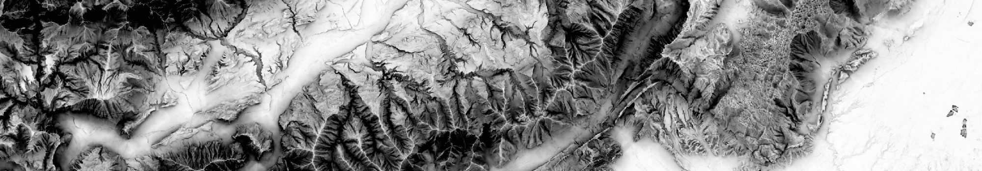
- (i) shaded relief map (TINItaly_Hillshade);
- (ii) slope map (TINItaly_Slope);
- (iii) Sky view Factor (SVF) map using 2.5σ clipping as technique for image enhancement (TINItaly_SVF_2d5);
- (iv) SVF map using equal area equalization as technique for image enhancement (TINItaly_SVF_EA);
- (v) openness down map using equal area equalization as technique for image enhancement (TINItaly_OD);
- (vi) Hue-Saturation-Value (HSV) composition image with slope (2.5σ clipping) as saturation and SVF (2.5σ clipping) as value, according to RRIM (Red Relief Image Maps) style maps (TINItaly_HSV);
- (vii) slope map using 2.5σ clipping as technique for image enhancement (TINItaly_Slope_2d5).
For more information about the generation of the DEM-derived products refer to Favalli and Fornaciai (2017).
The WMTS link is faster than the WMS one, but it may not work with some GIS software
| Name | GetCapabilities | TINITALY DEM-derived images obtained as illustrated in Favalli and Fornaciai (2017, https://doi.org/10.1016/j.geomorph.2017.02.029). |
|---|---|---|
| Tinitaly browsing DEM & other layers |  |