

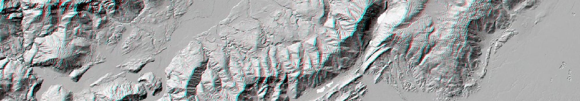
ItaliAnAglyph
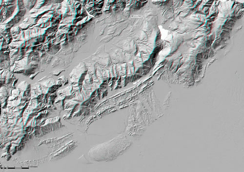
The human brain is equipped to produce a 3D perception of an observed scene by coupling two images acquired by the eyes from a slightly different point of view. This is the basic principle of the stereo vision, widely applied for the examination of couples of aerial stereoscopic photographs. The observation in stereo mode conveys a deeper understanding of landscape morphologies. The easiest way to obtain a 3D vision from a single image is by creating an “anaglyph”, i.e. an RGB image in which 2 perspective images of a given scene obtained from slightly different viewpoints are stored in different channels of a single image (typically R vs GB). By observing an anaglyph through appropriate lenses (a red one over the left eye and a green/blue one over the right eye) a 3D vision is usually obtained. Here we used a custom software which produces full-resolution anaglyph images from arbitrarily large DEMs, to obtain a seamless anaglyph layer of the full TINITALY/01 DEM database at 10-m resolution (Tarquini et al. 2012). No vertical exaggeration is applied.
The viewpoints for anaglyph creation are set at very large distance (thus obtaining a very low distortion), and are symmetric to a nadiral axis pointing toward the center of Italy. The anaglyph layer is geo-referenced in the UTM WGS 84 zone 32 projection system, and the ESRI ArcGIS pro software has been used to set up a webGIS navigation. We remind again that, in order to obtain a stereo vision, users must wear anaglyph glasses with a green (or blue) right lens and a red left lens.