

WCS service
A WCS (Web Coverage Service) allows using spatial data representing continuous variable phenomena in space / time in the form of coverage. The present WCS is implemented using the OGC™ (Open Geospatial Consortium Catalogue Services Specification 2.0.2), and provides access to spatial data in ways that are useful for client-side rendering, or as input into scientific models. Unlike a WMS and a WMTS, which return spatial data as static maps (represented as images), the WCS makes available spatial data with their attributes that can be interpreted, analyzed, processed, etc.
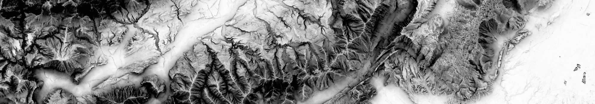
The OGC links supply, beside the DEM itself (TINItaly_DEM), the navigation of the following DEM-derived layers:
- (i) shaded relief map (TINItaly_Hillshade);
- (ii) slope map (TINItaly_Slope);
- (iii) Sky view Factor (SVF) map using 2.5σ clipping as technique for image enhancement (TINItaly_SVF_2d5);
- (iv) SVF map using equal area equalization as technique for image enhancement (TINItaly_SVF_EA);
- (v) openness down map using equal area equalization as technique for image enhancement (TINItaly_OD);
- (vi) Hue-Saturation-Value (HSV) composition image with slope (2.5σ clipping) as saturation and SVF (2.5σ clipping) as value, according to RRIM (Red Relief Image Maps) style maps (TINItaly_HSV);
- (vii) slope map using 2.5σ clipping as technique for image enhancement (TINItaly_Slope_2d5).
For more information about the generation of the DEM-derived products refer to Favalli and Fornaciai (2017).
| Name | GetCapabilities | TINITALY DEM-derived images obtained as illustrated in Favalli and Fornaciai (2017, https://doi.org/10.1016/j.geomorph.2017.02.029). |
|---|---|---|
| Tinitaly browsing DEM & other layers |  |